


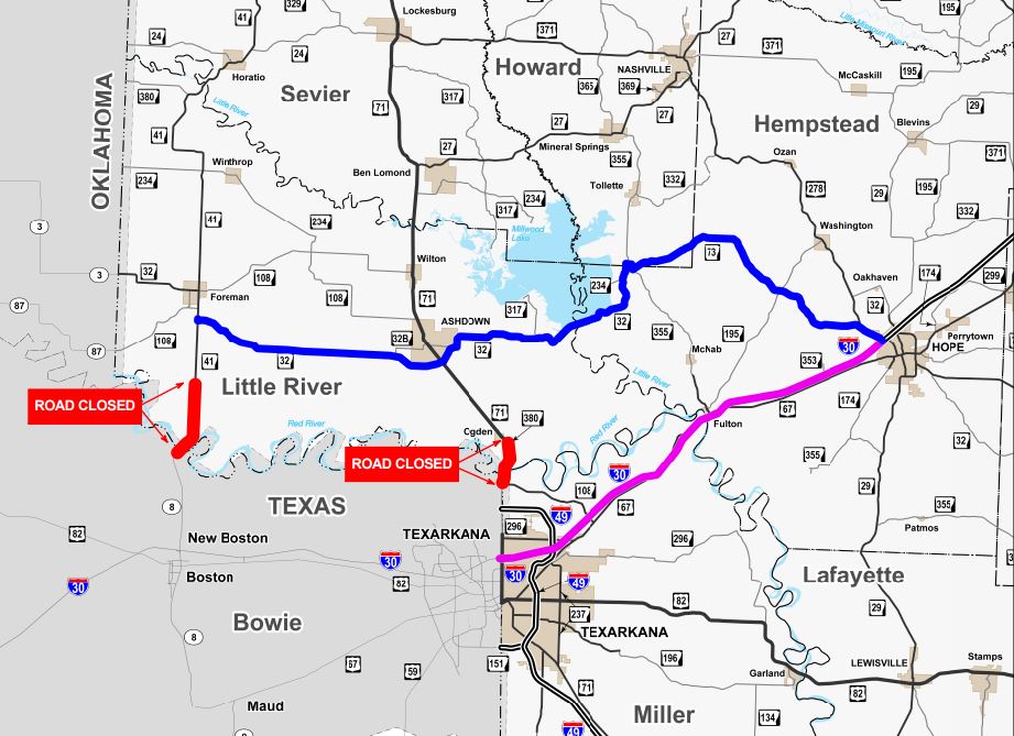
U.S. Highway 71 in Little River County
High water on U.S. Highway 71 north of the Red River has closed a section of the route north of the Texas state line. The closure includes 2.47 miles of U.S. Highway 71 between the Arkansas Welcome Center (south end) and the intersection with State Highway 380 at Ogden (north end). This section will remain closed until water recedes from the highway and a damage assessment can be made by AHTD engineers.
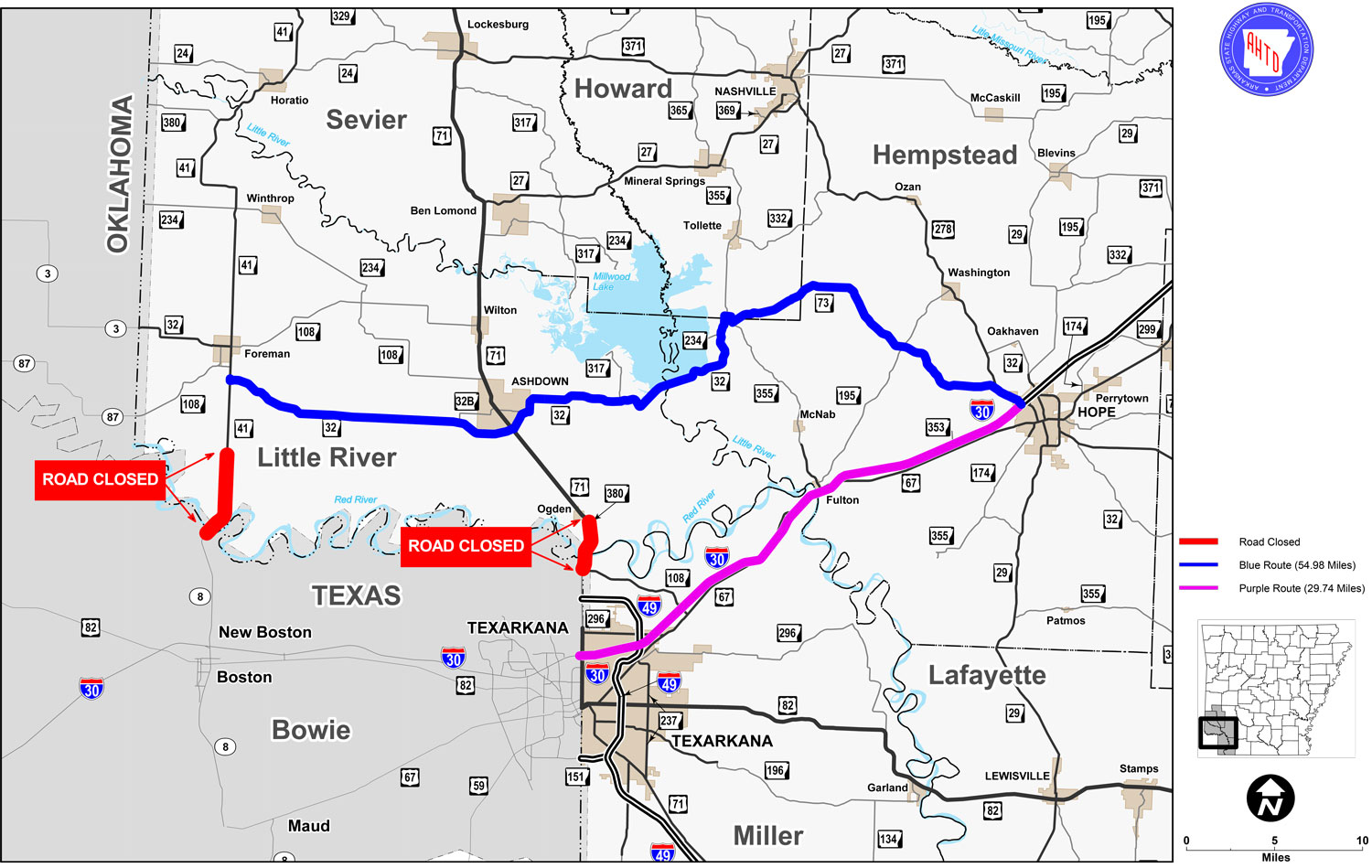
State Highway 41 in Little River County
High water on State Highway 41 north of the Red River has closed a section of the route north of the Texas state line. The closure includes 5.1 miles of State Highway 41 between the Texas state line (south end) and Mud Line Road (north end). This section will remain closed until water recedes from the highway and a damage assessment can be made by AHTD engineers.
State Highway 23 in Franklin County
Detours have been established to route traffic around a hill slide on State Highway 23 north of Cass. Approximately 700 linear feet of roadway is at risk of sliding. Large cracks have formed in the northbound and southbound travel lanes, rendering both impassable. This closure includes 3.2 miles of State Highway 23 between the Mulberry Mountain Lodge (south end) and Fly Gap Road (north end). The impacted section of highway will remain closed until repairs can be made. Delivery time for a solution has yet to be established.
Please refer to the detour map for alternate routes motorists may take to travel around the closed section of State Highway 23.
Last updated: May 29, 2015 1 p.m. .