
Saturday brings enhanced risk for severe thunderstorms
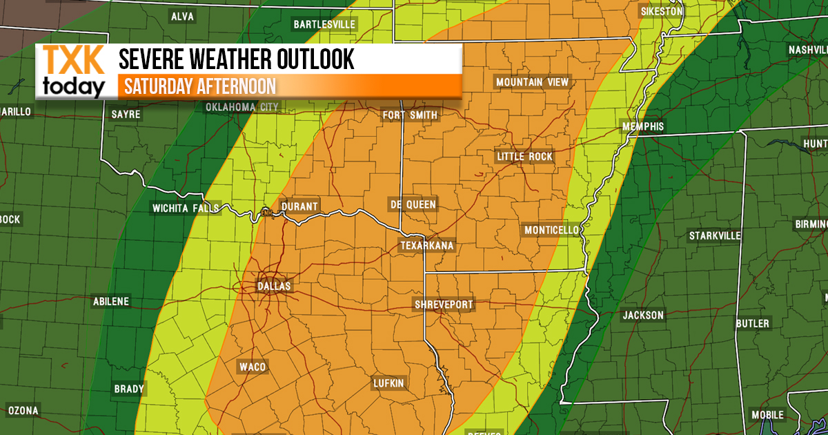
There is an Enhanced Risk for severe thunderstorms late Saturday for Southeast Oklahoma, much of Southwest Arkansas, East and Northeast Texas, and most of Northern Louisiana.
Showers and thunderstorms will increase Saturday afternoon and especially Saturday night along and ahead of a slow moving cold front.
All severe weather modes will be possible, with large hail, damaging winds, isolated tornadoes, and locally heavy rainfall which may result in flash flooding, especially over Southeast Oklahoma and the northern sections of Southwest Arkansas.

Rain will become widespread across the entire Four State Region late Saturday Night and into Sunday. The heaviest rainfall should fall across the Middle Red River Valley of Southeast Oklahoma and portions of Southwest Arkansas where 4 to 6 inches will be possible. Further south towards the Interstate 20 Corridor of Northeast Texas and Northern Louisiana, widespread 2-4 inches will be possible with isolated higher amounts. Otherwise, 1-2 inches will be possible with isolated higher amounts.