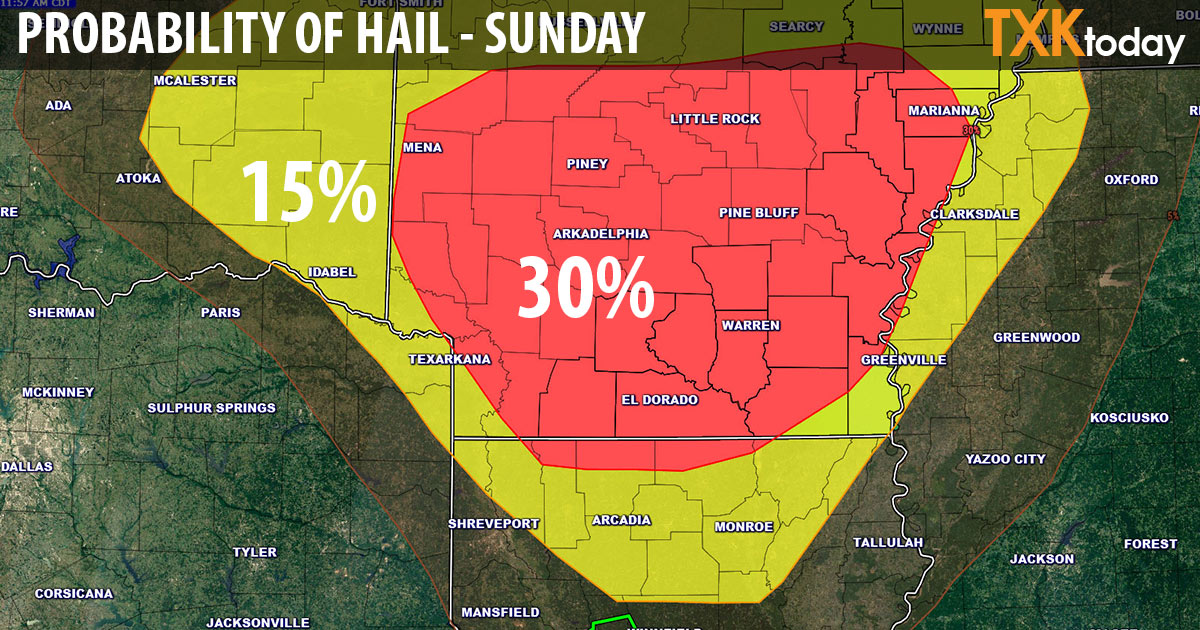
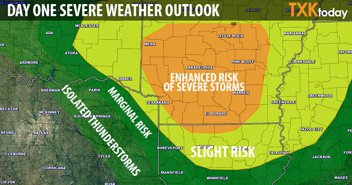
Severe weather possible Sunday afternoon
Isolated to scattered thunderstorms will rapidly develop this afternoon across southeast Oklahoma, southwest Arkansas, extreme northeast Texas, extreme northwest Louisiana and portions of north central Louisiana.
According to the National Weather Service a few storms may become severe with large hail being the main severe weather threat. Strong to possible damaging wind gusts may also occur and an isolated tornado could be possible, especially over southwest Arkansas.
Rainfall will be spotty with these storms. However, any locations that receive even brief heavy rainfall may experience renewed flooding.

Thunderstorms may produce large hail, deadly lightning, strong to possibly damaging wind gusts and brief heavy rainfall. Trees with soggy roots from ongoing major flooding will easily topple with even sub severe wind speeds and possibly even with 20 mph afternoon winds that are expected across portions of the area south of interstate 20 where thunderstorms may not even occur.