
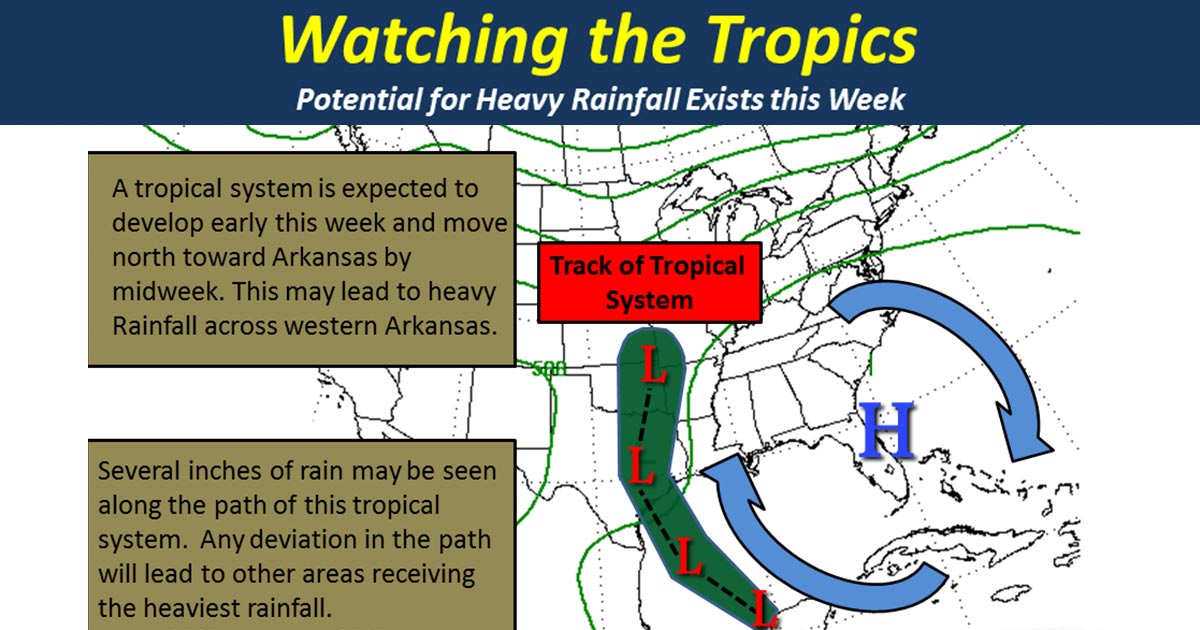
Tropical system likely to bring heavy rain by midweek
According to the National Weather Service a tropical system may make its way toward the Texarkana area from the south by mid week.
The National Weather Service out of Little Rock says, “if this system follows the expected track, heavy rainfall could occur across western parts of the state by Wednesday. We will have to watch this system closely as any change in its path could lead to areas of heavy rainfall in other areas possibly.”
The following graphic created by the NWS out of Shreveport represents POTENTIAL rainfall totals through early Friday morning.

According to NWS Shreveport “it’s becoming increasingly likely that a heavy rain event will occur between Tuesday and Thursday. There is still too much uncertainty regarding both rainfall amounts and the location of the heaviest rainfall to predict what the impacts on area rivers will be. However, renewed and/or additional flooding along area rivers, lakes, and bayous could become a possibility in the coming days.”
