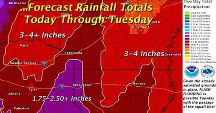
The National Weather Service has issued a special weather statement for the Texarkana area.
Thunderstorms will continue to increase in areal coverage and intensity overnight especially on Tuesday as a strong upper level storm system shifts eastward from the rockies. A developing squall line along the front will intensify and may affect portions of northeast texas and southeast oklahoma after midnight and before sunrise Tuesday morning.
Some storms may be severe and could be capable of producing damaging winds, large hail, and isolated tornadoes. Locally heavy rainfall could also produce flash flooding.
[AdSense-A]
An intense squall line of strong to severe thunderstorms is expected to develop early tuesday morning across central texas and Oklahoma ahead of a cold front and strong upper level storm system over the plains. The rapid movement of this line of thunderstorms will pose a threat of damaging wind, large hail, and isolated tornadoes.
Two to four inches of rainfall will be possible with this system which could result in flash flooding. Therefore a Flash flood watch is in effect from 6 am tuesday morning through Tuesday night. These threats will diminish from west to east late on tuesday as the front exits the region.


