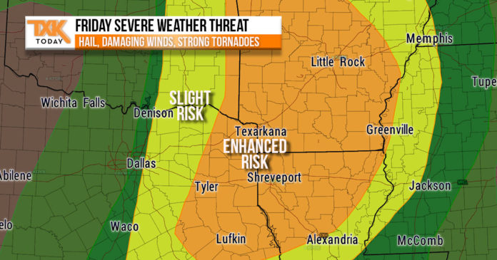
The threat of severe storms with large hail, damaging winds, and potentially strong tornadoes will increase starting on Friday afternoon and continue through early Saturday morning.
According to the National Weather Service, “severe thunderstorms will be possible on Friday afternoon and possibly lingering into Saturday morning. Large hail, damaging winds, tornadoes, and locally heavy rainfall can be expected on Friday afternoon with organized thunderstorms.”
“Severe potential will shift into more of a heavy rain and damaging wind threat as storms evolve into a squall line Friday evening ahead of a cold front which will be arriving late Friday night through early Saturday morning. The severe threat should be ending prior to daybreak on Saturday with the cold front gradually clearing the region later in the morning. Rainfall totals as high as four inches may be possible across portions of north-central Louisiana and south-central Arkansas.”
[AdSense-B]


